

Valbona area


Key information: Valbona area 
- The high Valbona National Park in Albania's far north is walking heaven. Break out above the steep valley was to the superb highlands above the treeline.
- A fine selection of options. Not to be missed if in the country.
Walkopedia rating
- Walkopedia rating95
- Beauty35
- Natural interest16
- Human interest11
- Charisma34
- Negative points1
- Total rating95
- Note: Neg: popularity; crowding in high season
Vital Statistics
- Length: Your choice
- Maximum Altitude: 2,100m
- Level of Difficulty: Variable

WALK SUMMARY
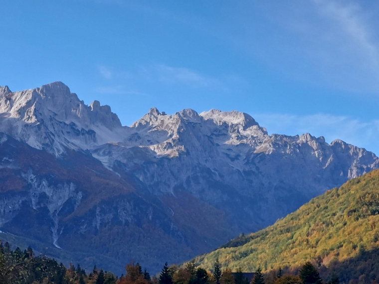
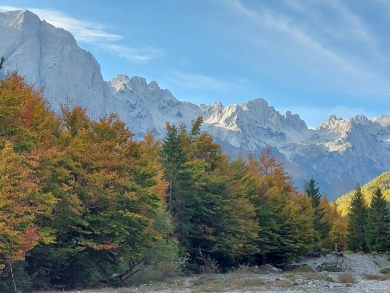
This village sits at around 900m in a perfect wide, grassy valley, with secondary-but-lovely forests and high jagged limestone peaks all around. It is very reminiscent of the Dolomites [link] and Julian Alps [link], with which the Accurseds are part of a long limestone Balkan spine. Take in the machine gun 'mushroom' bunkers on the valley floor, mementos of the paranoia of the horrendous Hoxa regime.
While the lower valley wall is generally very steep, there are gaps through which you can break out to the superb highlands above the treeline. Some walking options:
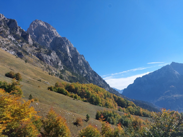
Kukaj circuit: An easy-ish 1.5 hour circuit takes you northwards across the river and up through mixed forest to the hamlet of Kukaj at around 1,150m, to gain fine views across the valley, then descends on another path back to the valley floor. A good heart-starter if arriving in the afternoon after taking the Lake Komani ferry.
Grykat e Hapta: Another starter walk takes you up to the meadows at Grykat e Hapta for huge views over the valley. A longer walk (climb nearly 500m, approaching 4 hrs), but a stunner.
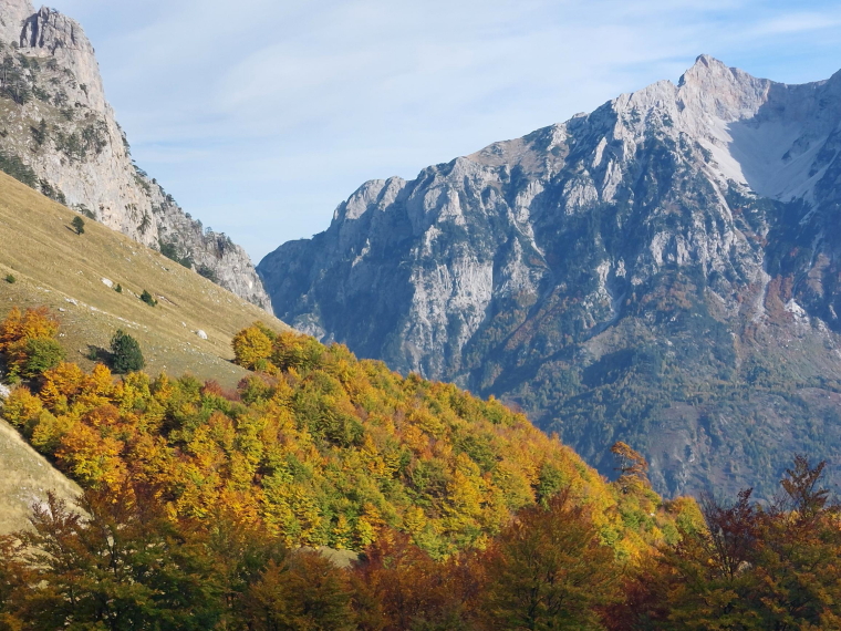
High above Kukaj: A really thrilling day walk takes you back up to Kukaj, then on, through lovely forests of beech then pine, to an old stone shepherd's hut at 1,680m for views galore and a drink - raki for the bold (reckless?). You can get back in around 5-6 hrs, having climbed 760m.
But the true glory requires a further steep 1.5 hr slog, now above the tree line, to the Piramida 18 pass (it goes by various names, but this was a Hoxa era border checkpoint name) at around 2,100m. Here you gaze northwards across the remote Vuthaj (Vusanje) valley to a line of grim buttress-cliffs which remind one of Mordor, or indeed of somewhere accursed. We ate a joyous picnic here in warm October sun. Distilled happiness.
The descent is... er... a long way down, but always beautiful. You will be happy to get back to a hot mug of something in the village. 7-8 hours return from the high pass.
Climbing to the Valbona to Pass to Thethi, at 1,295m, in the magnificent circle of cliffs at the valley-head. If you aren't anyway walking on to Thethi on the Peaks of the Balkans trail, this is a must-do walk. Some 800m ascent/return, in 5-7 hrs from the roadhead below Rrogam or getting on for 8km extra (9-11 hrs total) from Valbona village.
Valbona village is being developed hard, to very varying effect, but Walko stayed in the charming Kol Gjoni guesthouse, with its warm and characterful dining room, complete with log fire.
This can be tough walking in remote mountains with uncertain weather. Come fully prepared.
The Peaks of the Balkans Trail: Montenegro, Albania and Kosovo (International Trekking) (Cicerone Trekking) Paperback – 6 Nov. 2017: as usual, an inspiring book, packed with valuable information on the Valbona Pass route, including excellent detail on the route. Recommended.
Find this and other books on Amazon.
See our Accursed Mountains page for more general and practical information and photos.
We want to tell more - please send us your ideas, suggestions, experiences and photos.
Other accounts: share your experiences
Your comments on this walk, your experiences and suggestions, and your photos are very welcome. Where appropriate, you will be credited for your contribution.

Safety and problems: All walks have inherent risks and potential problems, and many of the walks featured on this website involve significant risks, dangers and problems. Problems of any sort can arise on any walk. This website does not purport to identify any (or all) actual or potential risks, dangers and problems that may relate to any particular walk.
Any person who is considering undertaking this walk should do careful research and make their own assessment of the risks, dangers and possible problems involved. They should also go to “Important information” for further important information.

Anyone planning an expedition to this place should see further important information about this walk.

Responsible travel matters, a lot. How you travel will make a real difference - for better or worse. PLEASE consider this when making plans. Read more
Contents
Other great walks in Albania
RESEARCH ESSENTIALS
Information and review
Finding flights, organising travel
Car hire
Accommodation
- Booking.com
 Search and book the best places to stay
 -
TripAdvisor
Equipment & Clothing
Books and Maps
- Amazon
- Maps and guides from Maps Worldwide
- Cicerone � explore the world�s best collection of walking books
Holidays and Activities

MAGAZINE

Walking with Trees: the Kumano Kōdō Kōhechi - Stephen Barber's account and photos of one of Japan's great pilgrimage trails. March 2021
RESPONSIBLE TRAVEL
Responsible travel matters, a lot. How you travel will make a real difference - for better or worse. PLEASE consider this when making plans. Read more